Best Scenic Drives Near Moab Worth Adding to Your Trip
Moab is famous for its national parks. What doesn’t get enough attention is what happens when you stop hiking, get back in the car, and just drive. The best Moab scenic drives range from easy paved river roads to high-clearance backcountry routes, so the right choice depends on your vehicle, available time, and comfort level.
Some of the best visual experiences near Moab happen through a windshield: canyon walls closing in around you, the Colorado River appearing hundreds of feet below a hairpin turn, desert giving way to alpine forest in the span of a few miles, red rock catching late-day light that makes everyone in the car suddenly very quiet.
Or very loud about pulling over again.
The scenery doesn’t start at the park entrances. It begins before you arrive and keeps going long after leaving. Think of this as a practical guide to the most worthwhile scenic routes near Moab — from easy paved drives any vehicle can handle to routes that need a lot more respect — including which arrival routes double as part of the experience.
Moab Scenic Drives at a Glance
| Scenic Drive | Surface | Approximate time | Best for |
|---|---|---|---|
| Highway 128 | Paved | 2–3 hours | River scenery and sunset |
| Potash Road | Paved, then off-road | 1.5–2 hours for paved section | Petroglyphs and a shorter drive |
| Highway 313/Grand View Point Road | Paved | 1.5–2+ hours | Canyonlands overlooks |
| La Sal Mountain Loop | Paved, narrow and steep | 2.5–4 hours | Mountain views and fall color |
| Arches Scenic Drive | Paved | 2–3 hours | Iconic formations and short hikes |
| Kane Creek Road | Paved, then dirt | Flexible | A close-to-town option |
| Shafer Trail/White Rim | Backcountry | Varies considerably | Experienced 4×4 travelers |
If you only add one drive outside the national parks, choose Highway 128 — especially near sunset.
1. Highway 128 / Upper Colorado River Scenic Byway
44 miles one way | Paved | All vehicles | 2–3 hours with stops
Highway 128 is our favorite scenic drive near Moab, and one of those roads that feels almost unfairly overlooked because there’s so much else competing for your attention in the area.
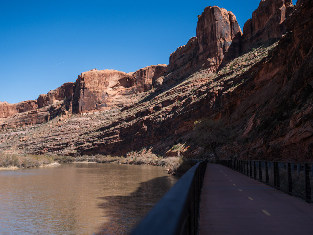
The route starts just north of Moab and follows the Colorado River through a canyon corridor of red sandstone walls, cottonwoods, and wide-open desert scenery. For the first 13 miles, the road hugs the river through a narrow gorge — every bend opens a new frame of cliffs and water.
Past the canyon, the valley opens into Castle Valley, where formations like Castleton Tower and the Priest and Nuns rise out of the landscape like they were designed for a Western movie backdrop. Near mile 24.7, the Fisher Towers viewpoint frames those red spires against the La Sal Mountains in a way that stops photographers mid-sentence.
Near sunset, the light on the cliffs and river can be ridiculous in the best way. The colors all seem to have made an agreement before you got there.
Highway 128 also works as a scenic arrival route if you’re coming from Grand Junction or anywhere east of Moab — more on that below.
Best for: sunset drives, river scenery, first-time visitors, photographers, and anyone who wants a gorgeous paved drive with no park pass required.
2. Potash Road / UT-279 / Lower Colorado River Scenic Byway
17 paved miles one way | Paved for all vehicles; off-road beyond | 1.5–2 hours round trip for paved section
Potash Road follows the Colorado River west of Moab with a tighter, more condensed feel than Highway 128 — packed with stops along the paved stretch. Sandstone cliffs, petroglyphs, dinosaur track areas, Wall Street rock climbing, river views, and the Corona Arch trailhead all appear before the pavement ends.
For most travelers, the paved section is the point. Drive it slowly, stop where it makes sense, and turn around before the road becomes something you immediately regret attempting in a rented Corolla — especially if you skipped the extra insurance.
Because yes, this route changes.
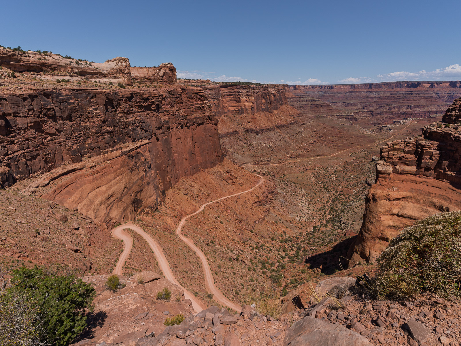
Past the potash plant, the road continues as a dirt track connecting to the Shafer Trail — a 1,500-foot climb via switchbacks on single-lane shelf roads with outside edges dropping hundreds of feet to the canyon floor below. Those overlooks with the Colorado River impossibly far below will leave you speechless and smiling ear to ear.
It is one of our favorite Moab memories. You are not standing at an overlook. You are down in it.
Vehicle note: The paved section works for regular passenger vehicles. Do not continue past the pavement without a proper high-clearance 4WD vehicle and current road-condition information.
Best for: river scenery, petroglyphs, Corona Arch access, close-to-town exploring, and travelers who want an easy scenic drive that can become a serious adventure with the right vehicle.
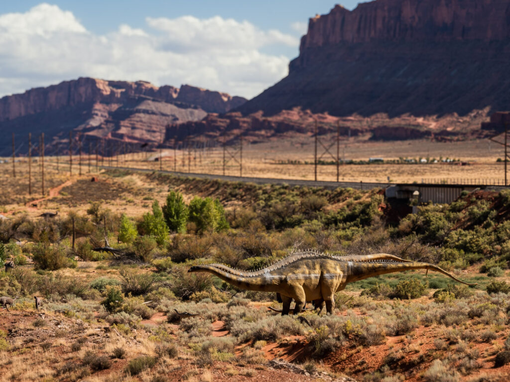
3. Highway 313 and Grand View Point Road — Canyonlands Island in the Sky
34 miles one way from US-191 to Grand View Point Overlook | Paved | All vehicles | 1.5–2+ hours with stops | Park pass required for Canyonlands section
This drive takes you from the canyon floor to some of the biggest overlooks in Canyonlands National Park — and the time can vary widely if you’re making it a full park day with hiking added in.
Highway 313 leads toward both Dead Horse Point State Park and Canyonlands Island in the Sky. The road climbs steadily through open canyon country, then eventually gives you a choice: curve toward Dead Horse Point, or continue onto Grand View Point Road into Canyonlands.
Dead Horse Point is dramatic and easy to pair with a Canyonlands day, but it has a separate entrance fee. If you’re short on time or keeping costs down, you’re perfectly fine skipping it and continuing into Canyonlands — you won’t feel like you missed the main event.
Canyonlands Island in the Sky deserves real time. Mesa Arch, Green River Overlook, Shafer Canyon Overlook, and Grand View Point are among the best Moab road trip stops in the area. If you’re trying to compare the scenic drives in Arches and Canyonlands, Canyonlands delivers broader overlooks and a more expansive, rugged atmosphere, while Arches places its iconic formations closer to the road. The overlooks here move from one massive view to the next.
Vehicle note: Paved and suitable for regular passenger vehicles. Check conditions in winter or shoulder seasons.
Best for: canyon overlooks, big views, first-time Canyonlands visitors, and travelers who want scenery without a difficult hike.
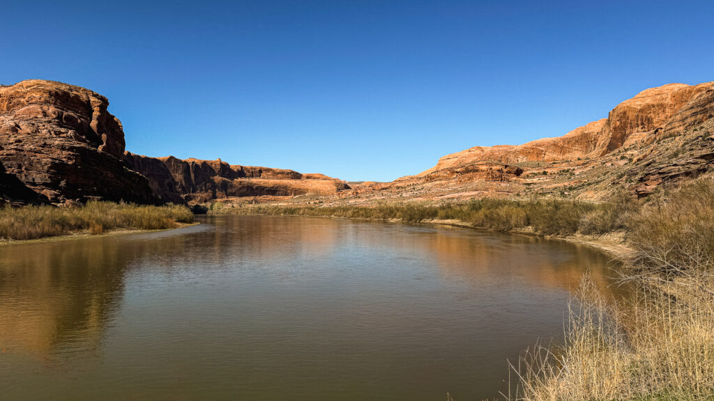
4. La Sal Mountain Loop Road
60-mile loop | Fully paved but narrow and steep | Not suitable for large RVs or trailers | 2.5–4 hours with stops
La Sal Mountain Loop Road is the drive to choose when you want Moab to surprise you.
Most people picture red rock and canyon walls when they think of Moab. This route heads toward the La Sal Mountains, where the scenery shifts into alpine forest, cooler air, and wide overlooks back toward canyon country below. You leave red rock desert, pass through pinyon and juniper, then enter aspen and pine at elevation. By the overlooks near 8,300 feet, you’re looking back down at everything you just drove away from.
Fall is exceptional — aspens turning against a desert backdrop in a way that feels almost designed.
No services on this route, so fuel up and bring water before you start. Large RVs and trailers should skip it — the switchbacks are narrow and unforgiving even though the map says “road.” Check conditions before going, especially outside summer and early fall.
Best for: mountain views, cooler temperatures, repeat visitors, fall color, and anyone wanting a desert-to-alpine contrast.
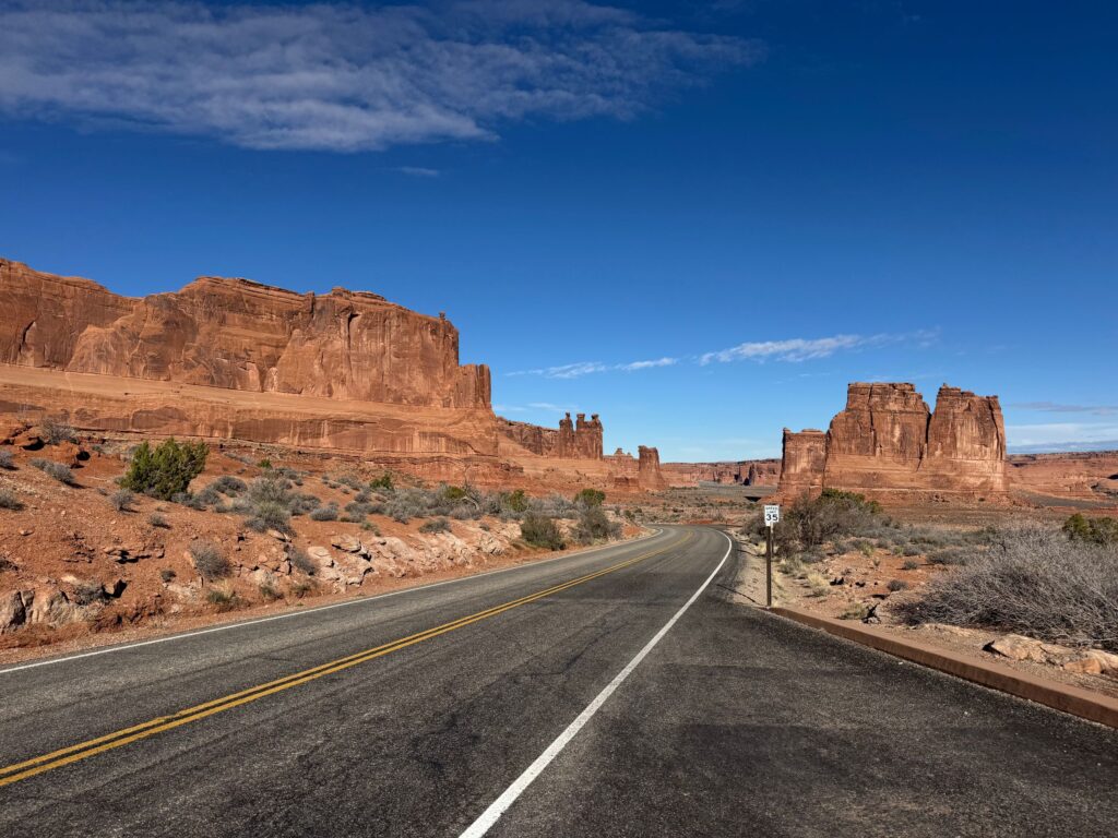
5. Arches Scenic Drive
About 18 miles one way to Devils Garden | Paved | Park pass required | 2–3 hours with stops
The main paved route through Arches National Park belongs on this list because for first-time visitors it’s one of the most important Moab scenic drives you’ll do. Balanced Rock, the Windows, Delicate Arch access, Fiery Furnace, Devils Garden — the road connects the iconic formations with pullouts and optional hikes at every major stop.
Just like driving through Canyonlands, this drive time depends on how much hiking you do in the park.
Start early. Parking lots fill. Wear real shoes if you plan to get out.
Best for: first-time Moab visitors, iconic formations, short hikes, and national park photography.
What to Expect at Arches National Park for Your First Visit
6. Kane Creek Road
Flexible out-and-back close to town | Starts paved, transitions to dirt
Kane Creek Road is a good option if you want something scenic close to Moab without committing to a full-day route. The paved section hugs parts of the Colorado River as it follows a canyon corridor southwest of town — cliffs, petroglyphs, campgrounds, and climbing areas along the way.
The early sections are manageable for regular vehicles, and the transition to dirt is a natural turnaround point. Farther along, it shifts from scenic drive toward adventure route. Drive until it makes sense, enjoy the canyon setting, and turn around before a casual outing becomes a vehicle-confidence exam you might fail.
That’s a pretty common Moab theme, honestly.
Best for: close-to-town exploring, canyon scenery, petroglyphs, and flexible add-on time.
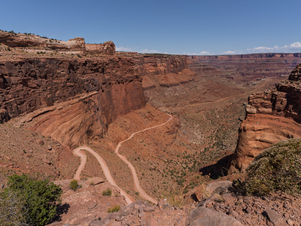
7. Off-Road Options: Shafer Trail, White Rim, and More
For travelers with a capable 4×4 and the experience to use it, the Moab area has some of the most dramatic off-road driving in the country.
The Shafer Trail drops from Island in the Sky into canyon country through switchbacks and shelf-road views that are genuinely unforgettable. High-clearance 4WD, good conditions, and real route knowledge are required.
White Rim Road is a bigger commitment — permits, serious planning, high-clearance 4WD, and far more time than a standard scenic drive.
Important rental car note: Check your rental agreement before driving any backcountry route. Many standard rentals are restricted to paved roads, and towing or repairs out there gets expensive fast.
If you want the off-road experience without handling navigation yourself, a guided Jeep or UTV tour is worth considering. That’s not less adventurous — that’s just knowing when to let someone else worry about whether this is, in fact, still the road.
Best Tours Near Moab Worth Considering
Bonus: Scenic Arrival Routes Into Moab
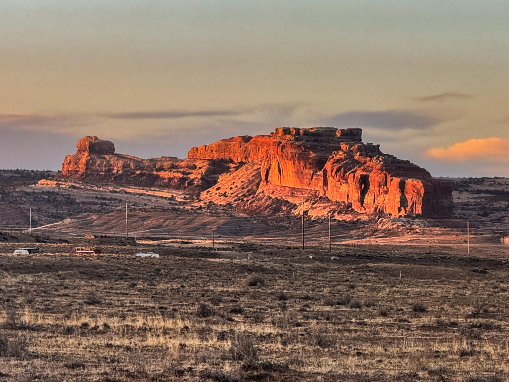
From Salt Lake City: About 4 Hours
The standard route — I-15 south to US-6 east through Price Canyon, then I-70 east to US-191 south — is already more scenic than most people expect. Price Canyon passes through real mountain terrain, and the I-70 run through the San Rafael Swell delivers canyon and high desert scenery before you even arrive. We’ve made this drive countless times and never get tired of it.
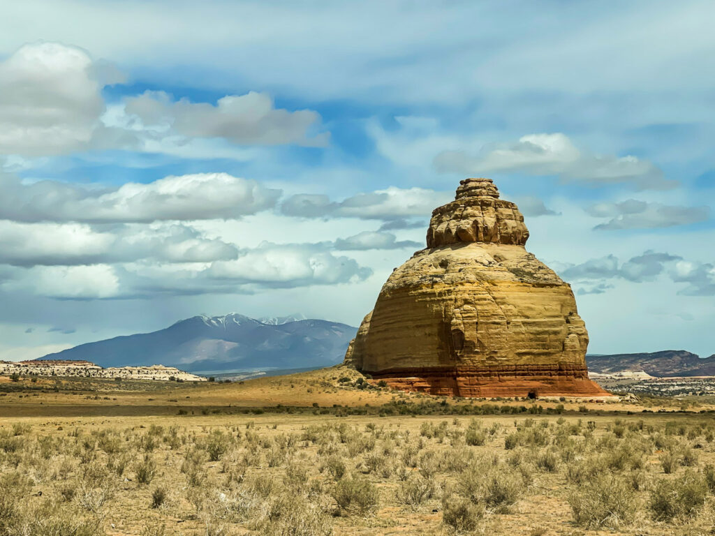
From Grand Junction: About 2 Hours by Direct Route
Taking Highway 128 from the Cisco area on I-70 into Moab adds roughly 45 minutes to an hour over the direct US-191 route, depending on how often you stop.
You will probably stop.
The Colorado River corridor through Castle Valley with Fisher Towers in the distance turns your arrival into part of the experience. If your schedule allows it, this is an easy yes.
A Few Things to Know Before You Go
Download offline maps before leaving town. Cell service on Highway 128 fades quickly and disappears on backcountry routes.
Bring water and snacks. Even a casual drive can turn into several hours once you start stopping. La Sal Mountain Loop and longer routes have zero services along the way.
Watch the light. Highway 128 and Potash Road can be especially beautiful in late-afternoon light, when sections of the canyon walls begin to glow on the return drive toward Moab. Dead Horse Point is worth timing around sunrise or sunset if you add it.
Plan Your Drives
The best scenic drives near Moab don’t all require the same vehicle, the same commitment, or the same amount of planning. Some are easy paved routes anyone can do. Some are scenic park roads. Some are adventure drives that need the right vehicle and honest comfort level behind the wheel.
Match the route to your day and your rig — then give it enough daylight to actually stop when you want to.
Use our complete Moab trip guide to see how scenic drives fit alongside the national parks and other experiences. To balance time behind the wheel with time on the trail, pair a scenic drive with an easy Moab hike. Before choosing too many routes, consider how you’ll fit these drives into your Moab itinerary without crowding out the parks and other experiences.
Before heading out, browse our Moab navigation and route-planning tools for offline-map apps, official park maps, and other useful links.